
Transform Data into Visual Contours with 3DField
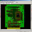
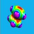
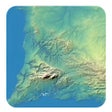
3DField is a powerful Windows application designed for creating contour maps and surface plots from numerical data. It caters to scientists, engineers, and educators by allowing users to visualize complex datasets in a three-dimensional format. The software supports various data formats and facilitates easy import, enabling quick transformations into visually appealing graphics. With user-friendly tools, it provides options for customizing colors, scales, and grid types, enhancing the visual representation of data.
In addition to its mapping capabilities, 3DField integrates seamlessly with other data analysis applications, allowing for a smooth workflow. The trial version provides a comprehensive feature set, enabling users to explore its functionality before committing to a purchase. Accessibility features enhance usability for a diverse range of users, while the intuitive interface ensures that even those with limited technical experience can create sophisticated visualizations. Overall, 3DField stands out in the learning category for its effectiveness and ease of use.