Meander: Plot and Measure Routes
Screenshots
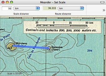
Meander is a discontinued program that allowed users to plot and measure routes on any map. Whether it was a scanned map, an online map, or a map from your computer, Meander provided the tools to add notes, plot points, and measure distances. It was particularly useful for hiking, as it allowed users to keep a journal with specific observations on points along their route. The program was easy to use and offered the ability to export or print maps with observations to share with others. However, Meander did have some limitations, such as the inability to save presets and the requirement to manually place the application over your Mac to make it work. Despite these drawbacks, Meander was an excellent route planning tool for those looking to add notes and measure distances on maps.


