Geophoto: Put Your Photos on the Map
Screenshots
Geophoto is a great trial version program available exclusively for Mac. It falls under the category of Design & Photography with a subcategory of Photo Albums & Viewers. Since its addition to our selection of programs and apps in 2007, Geophoto has garnered 257 downloads, with no downloads recorded last week. Compatible with Mac OS X and earlier versions, the program is available in English. Geophoto is a slick program that requires less storage space compared to other software in the Design & Photography section.
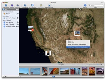
Geophoto allows users to geotag their photos, placing them on a map. By adding geographical information to your images, you can easily organize and locate them based on location. The program also offers the ability to import photos from Flickr, with the option to specify the number of photos to import at once. In addition, Geophoto includes bug fixes and improvements in its latest update.


